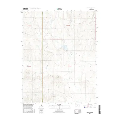
2016 Map of Proffitt Lake
USGS Topo · Published 2016About this map
Proffitt Lake sits at the center of this 2016 survey, where the drainages of the High Plains converge along the Meade Co and Clark Co line. The landscape is defined by a dense network of intermittent stream beds, including Johns Creek and Gyp Creek, which carve through the prairie towards the larger basin of Big Sandy Creek. In the northeastern corner, the notable geological depression of Big Basin interrupts the plateau, a significant landmark in this section of Southwest Kansas. The map documents the persistent section-line road grid, featuring routes like Q Road and CR S, which maintain the orderly agricultural division of the land even where the terrain becomes increasingly broken by the winding courses of Indian Creek and Twomile Creek.
Find a feature on this map
19 named features on this map. Tap any name to fly to it.
Don’t see what you’re looking for? This feature index may not catch every label — zoom into the map to look around manually.
Map Details
Editions of this 2016 Proffitt Lake Map
This is the sole edition of this map. No revisions or reprints were ever made.
Other maps of this area

1892 · Meade
USGS Topo · 1:125,000

1896 · Ashland
USGS Topo · 1:125,000

1955 · Pratt
USGS Topo · 1:250,000

1955 · Dodge City
USGS Topo · 1:250,000

1958 · Dodge City
USGS Topo · 1:250,000

1959 · Pratt
USGS Topo · 1:250,000

1959 · Dodge City
USGS Topo · 1:250,000

1967 · Fowler SE
USGS Topo · 1:24,000

1967 · Fowler SW
USGS Topo · 1:24,000

1972 · Ashland NW
USGS Topo · 1:24,000