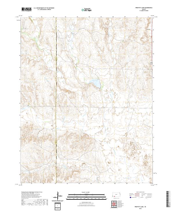
2022 Map of Proffitt Lake
USGS Topo · Published 2022About this map
Proffitt Lake sits at the heart of this landscape, a significant water feature amidst the drainage networks of south-central Kansas. The terrain is defined by a series of intermittent and perennial waterways, including the winding paths of Big Sandy Cr and Twomile Cr, which carve through the plains along the Meade Co/Clark Co border. A notable geological feature in the northeast corner is the Big Basin, a prominent circular depression that breaks the steady contour patterns of the surrounding ranchland. Roads like CR S and CR U follow the section lines of the Public Land Survey System, reflecting the traditional grid-based settlement and management of this rural territory. Smaller tributaries like Johns Cr and Indian Cr further detail the complex hydrology that supports the region's agricultural use.
Find a feature on this map
19 named features on this map. Tap any name to fly to it.
Don’t see what you’re looking for? This feature index may not catch every label — zoom into the map to look around manually.
Map Details
Editions of this 2022 Proffitt Lake Map
This is the sole edition of this map. No revisions or reprints were ever made.
Other maps of this area

1892 · Meade
USGS Topo · 1:125,000

1896 · Ashland
USGS Topo · 1:125,000

1955 · Pratt
USGS Topo · 1:250,000

1955 · Dodge City
USGS Topo · 1:250,000

1958 · Dodge City
USGS Topo · 1:250,000

1959 · Pratt
USGS Topo · 1:250,000

1959 · Dodge City
USGS Topo · 1:250,000

1967 · Fowler SE
USGS Topo · 1:24,000

1967 · Fowler SW
USGS Topo · 1:24,000

1972 · Ashland NW
USGS Topo · 1:24,000