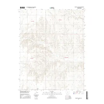
2016 Map of Proffitt Lake NW
USGS Topo · Published 2016About this map
Kleine Gemeinde Cem sits in the southern portion of this Meade County landscape, serving as a primary point of historical and genealogical interest. The terrain is defined by the drainage patterns of Sand Cr, which meanders across the center of the sheet, and Twomile Cr in the southeast. This map illustrates the intersection of several townships including t32s r27w and t33s r26w, where the section lines are traced by a rigid grid of local routes such as Q Rd, 24 Rd, and Y Rd. The lack of dense urbanization highlights the agricultural character of this region in the early 21st century, as rural road networks connect isolated farmsteads and open plains.
Find a feature on this map
18 named features on this map. Tap any name to fly to it.
Don’t see what you’re looking for? This feature index may not catch every label — zoom into the map to look around manually.
Map Details
Editions of this 2016 Proffitt Lake NW Map
This is the sole edition of this map. No revisions or reprints were ever made.
Other maps of this area

1892 · Meade
USGS Topo · 1:125,000

1955 · Dodge City
USGS Topo · 1:250,000

1958 · Dodge City
USGS Topo · 1:250,000

1959 · Dodge City
USGS Topo · 1:250,000

1962 · Irish Flats NE
USGS Topo · 1:24,000

1962 · Irish Flats SE
USGS Topo · 1:24,000

1963 · Meade
USGS Topo · 1:24,000

1967 · Fowler SE
USGS Topo · 1:24,000

1967 · Fowler SW
USGS Topo · 1:24,000
1972 · Proffitt Lake
USGS Topo · 1:24,000