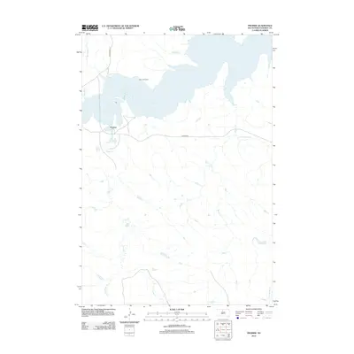
2012 Map of Promise
USGS Topo · Published 2012About this map
Lake Oahe dominates the northern landscape of this Dewey County region, where the Missouri River valley was transformed into a massive reservoir. The small settlement of Promise sits just south of the water, connected to the wider area by Promise Rd and Whitehorse Rd. The terrain is defined by a dense network of drainages that feed into the lake, including Virgin Cr, Beaver Cr, and Marshall Cr. For genealogists and local historians, the Saint Johns Cem is a significant landmark situated near the shoreline, overlooking the inundated valley. The map reveals the intricate natural hydrology of the Missouri Plateau, showing how numerous creeks such as Du Charme Cr and Tom Hill Cr carve through the prairie landscape toward the central waterway.
Find a feature on this map
12 named features on this map. Tap any name to fly to it.
Don’t see what you’re looking for? This feature index may not catch every label — zoom into the map to look around manually.
Map Details
Editions of this 2012 Promise Map
This is the sole edition of this map. No revisions or reprints were ever made.
Other maps of this area

1951 · Virginia
USGS Topo · 1:24,000

1951 · La Plant
USGS Topo · 1:24,000

1951 · Promise
USGS Topo · 1:24,000

1952 · Trail City SW
USGS Topo · 1:24,000

1953 · McIntosh
USGS Topo · 1:250,000

1958 · McIntosh
USGS Topo · 1:250,000

1968 · Moreau NW
USGS Topo · 1:24,000

1968 · Moreau
USGS Topo · 1:24,000

1970 · Patch Skin Buttes
USGS Topo · 1:24,000

1975 · Laundreaux Butte
USGS Topo · 1:24,000