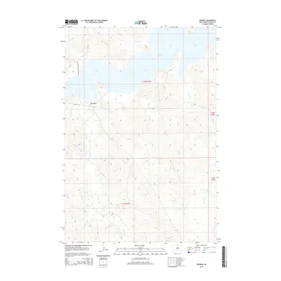
2015 Map of Promise
USGS Topo · Published 2015About this map
Promise sits at the center of this Dewey County landscape, where the high plains meet the vast waters of Lake Oahe. This modern survey illustrates the intersection of traditional land divisions and contemporary infrastructure, most notably The Native American Scenic Bywy (CR-1806) winding through the western sections. The hydrology of the region is defined by numerous drainages that feed into the reservoir, including Virgin Creek, Tom Hill Creek, and Du Charme Creek. The presence of Bureau of Indian Affairs routes like Bia-7 and local thoroughfares such as Promise Rd highlights the community's connection to the surrounding Missouri River breaks. The map provides clear evidence of the area's complex topography, tracing the deep ravines formed by Beaver Creek and Left Hand Bear Creek as they carve through the Missouri Plateau.
Find a feature on this map
18 named features on this map. Tap any name to fly to it.
Don’t see what you’re looking for? This feature index may not catch every label — zoom into the map to look around manually.
Map Details
Editions of this 2015 Promise Map
This is the sole edition of this map. No revisions or reprints were ever made.
Other maps of this area

1951 · Virginia
USGS Topo · 1:24,000

1951 · La Plant
USGS Topo · 1:24,000

1951 · Promise
USGS Topo · 1:24,000

1952 · Trail City SW
USGS Topo · 1:24,000

1953 · McIntosh
USGS Topo · 1:250,000

1958 · McIntosh
USGS Topo · 1:250,000

1968 · Moreau NW
USGS Topo · 1:24,000

1968 · Moreau
USGS Topo · 1:24,000

1970 · Patch Skin Buttes
USGS Topo · 1:24,000

1975 · Laundreaux Butte
USGS Topo · 1:24,000