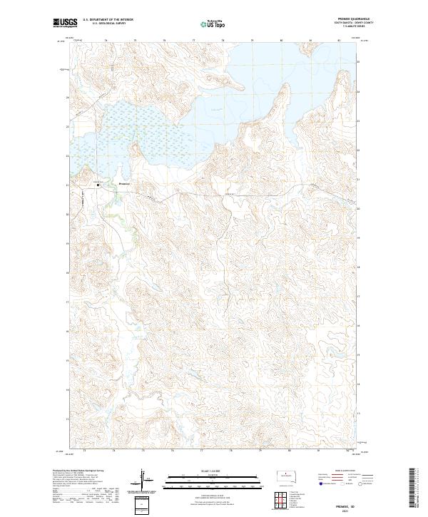
2021 Map of Promise
USGS Topo · Published 2021About this map
Promise is the focal point of this Dewey County landscape, situated on the high ground overlooking the expansive waters of Lake Oahe. The settlement pattern is defined by the network of local routes like Promise Rd and BIA Hwy 4 that connect the community to the surrounding drainages. Genealogy researchers will find the Promise Cem clearly marked west of the main settlement. The terrain is deeply dissected by numerous creeks, including Virgin Cr, Beaver Cr, and Left Hand Bear Cr, which carve through the plains to reach the reservoir. To the north, Tom Hill Cr and Du Charme Cr feed into the northern reaches of the lake. This survey documents the intersection of modern infrastructure and the natural hydrological systems that shape life in this part of South Dakota.
Find a feature on this map
19 named features on this map. Tap any name to fly to it.
Don’t see what you’re looking for? This feature index may not catch every label — zoom into the map to look around manually.
Map Details
Editions of this 2021 Promise Map
This is the sole edition of this map. No revisions or reprints were ever made.
Other maps of this area

1951 · Virginia
USGS Topo · 1:24,000

1951 · La Plant
USGS Topo · 1:24,000

1951 · Promise
USGS Topo · 1:24,000

1952 · Trail City SW
USGS Topo · 1:24,000

1953 · McIntosh
USGS Topo · 1:250,000

1958 · McIntosh
USGS Topo · 1:250,000

1968 · Moreau NW
USGS Topo · 1:24,000

1968 · Moreau
USGS Topo · 1:24,000

1970 · Patch Skin Buttes
USGS Topo · 1:24,000

1975 · Laundreaux Butte
USGS Topo · 1:24,000