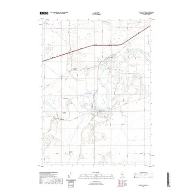
2021 Map of Prophetstown
USGS Topo · Published 2021About this map
The Rock River dominates this landscape of Whiteside County, carving a wide path past the settlements of Lyndon and Prophetstown. The river's influence is seen in the numerous secondary waterways and islands that define the local geography, such as Indian Island and Millwoods Island, alongside drainage features like Walker Slough and Paddock Slough. To the west, the elevation shifts at Thunderbolt Hill near Portland, while the smaller communities of Hamilton Corners and Denrock anchor the rural crossroads. For those tracing family histories or local land use, the map clearly identifies the Lyndon Cem and Washington Road Cem, set amidst a grid of county highways and named rural routes like Wood Chopper Rd and Moline Rd. The distribution of these roads reflects a well-established agricultural network that bridges the gaps between the riverfront towns and the surrounding plains of Coon Creek.
Find a feature on this map
35 named features on this map. Tap any name to fly to it.
Don’t see what you’re looking for? This feature index may not catch every label — zoom into the map to look around manually.
Map Details
Editions of this 2021 Prophetstown Map
This is the sole edition of this map. No revisions or reprints were ever made.
Other maps of this area

1891 · Clinton
USGS Topo · 1:62,500

1894 · Clinton
USGS Topo · 1:62,500

1899 · Clinton
USGS Topo · 1:125,000

1932 · Prophetstown
USGS Topo · 1:48,000

1934 · Morrison
USGS Topo · 1:48,000

1936 · Prophetstown
USGS Topo · 1:62,500

1940 · Morrison
USGS Topo · 1:62,500

1952 · Erie
USGS Topo · 1:62,500

1952 · Clinton
USGS Topo · 1:62,500

1958 · Davenport
USGS Topo · 1:250,000