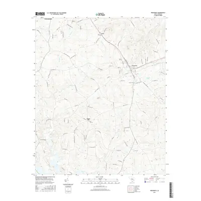
2017 Map of Prosperity
USGS Topo · Published 2017About this map
The town of Prosperity serves as the central hub in this contemporary landscape, where established residential streets like Elm St and Pine St meet regional thoroughfares. The surrounding area preserves a deep connection to its local heritage through numerous family and congregational burial grounds, including Saint Lukes Cem, Prosperity Cem, and Zion Cem. To the south, the terrain descends toward the northern reaches of Lake Murray, a significant hydrological feature that shapes the local geography along with Bush River and Little Cr. Smaller settlements such as Stoney Hill and Boyd punctuate the rural landscape, which is defined by a dense network of named roads like Bachman Chapel Rd and Hopewell Church Rd. This map captures the modern character of Newberry County, balancing its historic rural foundations with its current position as a crossroads near the Saluda River basin.
Find a feature on this map
93 named features on this map. Tap any name to fly to it.
Don’t see what you’re looking for? This feature index may not catch every label — zoom into the map to look around manually.
Map Details
Editions of this 2017 Prosperity Map
This is the sole edition of this map. No revisions or reprints were ever made.
Other maps of this area

1904 · Columbia
USGS Topo · 1:125,000

1941 · Spartanburg
USGS Topo · 1:250,000

1953 · Spartanburg
USGS Topo · 1:250,000

1960 · Spartanburg
USGS Topo · 1:250,000

1963 · Spartanburg
USGS Topo · 1:250,000

1964 · Spartanburg
USGS Topo · 1:250,000

1968 · Newberry East
USGS Topo · 1:24,000

1969 · Pomaria
USGS Topo · 1:24,000

1969 · Newberry West
USGS Topo · 1:24,000
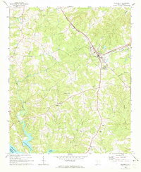
1970 · Prosperity
USGS Topo · 1:24,000