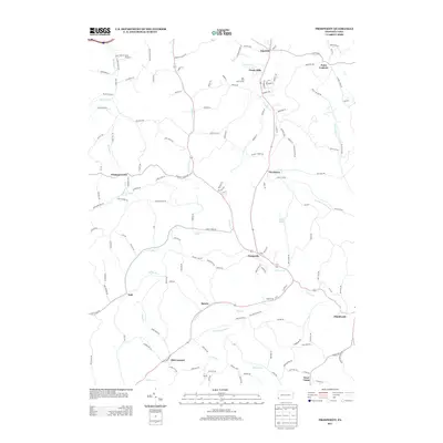
2013 Map of Prosperity
USGS Topo · Published 2013About this map
The winding valleys of Tenmile Cr and its many tributaries define the landscape of this Washington County survey from 2013. Small rural settlements are scattered throughout the hills, including Prosperity, Old Concord, and Van Buren, connected by a complex network of ridge-top and valley roads. The area shows a transition from agricultural land to residential enclaves such as Green Hills and recreational spaces like the Lone Pine Golf Course.
Find a feature on this map
143 named features on this map. Tap any name to fly to it.
Don’t see what you’re looking for? This feature index may not catch every label — zoom into the map to look around manually.
Map Details
Editions of this 2013 Prosperity Map
This is the sole edition of this map. No revisions or reprints were ever made.
Other maps of this area

1901 · Amity
USGS Topo · 1:62,500

1901 · Waynesburg
USGS Topo · 1:62,500

1904 · Amity
USGS Topo · 1:62,500

1904 · Waynesburg
USGS Topo · 1:62,500

1905 · Rogersville
USGS Topo · 1:62,500

1907 · Claysville
USGS Topo · 1:62,500

1949 · Clarksburg
USGS Topo · 1:250,000

1951 · Canton
USGS Topo · 1:250,000

1953 · Canton
USGS Topo · 1:250,000
1953 · Washington East
USGS Topo · 1:24,000
Featured Places
- East Finley Township, PA
- Green Hills, PA
- Point Lookout, South Franklin Township
- Sparta, Morris Township
- Gale, East Finley Township