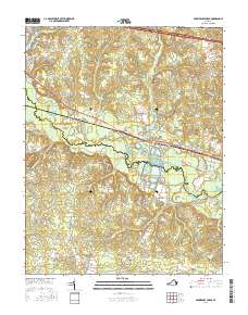
2016 Map of Providence Forge
USGS Topo · Published 2016About this map
The Chickahominy River forms a wide, meandering boundary between New Kent and Charles City counties, defining the center of this landscape. The settlement of Providence Forge sits at a critical junction where the river meets the road network, including the historic Pocahontas Trl. This area is characterized by extensive wetlands and swampy lowlands, such as Rumley Marsh and Big Swamp, which shaped early land use and transit patterns. Family and community history is preserved in several small burial sites, including Union Cem and Menoah Cem near the southern boundary. To the north, the residential development at Woodhaven Shores surrounds Kent Lake, illustrating the more modern expansion of the corridor between Richmond and Williamsburg. Significant landmarks like Minitree Hill and Old Forge Pond provide topographical anchors in an otherwise low-lying fluvial environment.
Find a feature on this map
86 named features on this map. Tap any name to fly to it.
Don’t see what you’re looking for? This feature index may not catch every label — zoom into the map to look around manually.
Map Details
Editions of this 2016 Providence Forge Map
This is the sole edition of this map. No revisions or reprints were ever made.
Other maps of this area

1917 · Toano
USGS Topo · 1:62,500

1918 · Charles City
USGS Topo · 1:62,500

1918 · Toano
USGS Topo · 1:62,500

1919 · New Kent
USGS Topo · 1:62,500

1920 · King William
USGS Topo · 1:62,500

1943 · Richmond
USGS Topo · 1:250,000
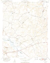
1949 · Quinton
USGS Topo · 1:24,000

1949 · Tunstall
USGS Topo · 1:24,000

1949 · New Kent
USGS Topo · 1:24,000

1949 · Richmond
USGS Topo · 1:250,000