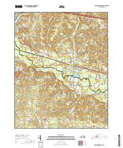
2019 Map of Providence Forge
USGS Topo · Published 2019About this map
The Chickahominy River winds through this landscape, defining the boundary between New Kent and Charles City counties. The historic crossroads of Providence Forge serves as a central hub, where the modern corridor of Pocahontas Trl intersects with a network of rural routes like Mountcasle Rd and S Court House Rd. To the north, the lakeside residential development of Woodhaven Shores sits near the Toe Ink Swamp, while to the south, the settlement of Sandybottom is tucked between Courthouse Cr and Collins Run.
Find a feature on this map
87 named features on this map. Tap any name to fly to it.
Don’t see what you’re looking for? This feature index may not catch every label — zoom into the map to look around manually.
Map Details
Editions of this 2019 Providence Forge Map
This is the sole edition of this map. No revisions or reprints were ever made.
Other maps of this area

1917 · Toano
USGS Topo · 1:62,500

1918 · Charles City
USGS Topo · 1:62,500

1918 · Toano
USGS Topo · 1:62,500

1919 · New Kent
USGS Topo · 1:62,500

1920 · King William
USGS Topo · 1:62,500

1943 · Richmond
USGS Topo · 1:250,000
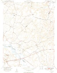
1949 · Quinton
USGS Topo · 1:24,000

1949 · Tunstall
USGS Topo · 1:24,000

1949 · New Kent
USGS Topo · 1:24,000

1949 · Richmond
USGS Topo · 1:250,000