
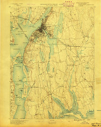
1887 Map of Providence
USGS Topo · Published 1887About this map
The Blackstone River serves as the industrial spine of this late 19th-century landscape, driving a dense network of textile and manufacturing operations. Massive industrial complexes like the Sayles Bleachery, Conant Thread Co., and Dunnell Print Works define the corridor from Central Falls through Pawtucket. The urban core of Providence is remarkably detailed, showing the concentration of civic life at the Cove Depot and institutional landmarks including the Dexter Asylum, Friends School, and the extensive grounds of the Butler Hospital.
Find a feature on this map
196 named features on this map. Tap any name to fly to it.
Don’t see what you’re looking for? This feature index may not catch every label — zoom into the map to look around manually.
Map Details
Editions of this 1887 Providence Map
This is the sole edition of this map. No revisions or reprints were ever made.
Other maps of this area

1885 · Taunton
USGS Topo · 1:62,500

1886 · Blackstone
USGS Topo · 1:62,500

1886 · Dedham
USGS Topo · 1:62,500

1887 · Franklin
USGS Topo · 1:62,500
1888 · Fall River
USGS Topo · 1:62,500

1888 · Taunton
USGS Topo · 1:62,500

1889 · Providence
USGS Topo · 1:62,500

1889 · Blackstone
USGS Topo · 1:62,500

1889 · Franklin
USGS Topo · 1:62,500
1889 · Burrillville
USGS Topo · 1:62,500