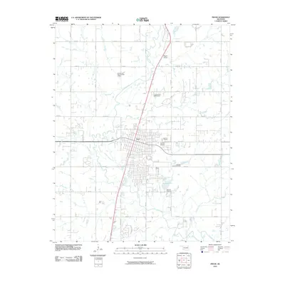
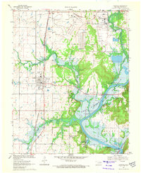
2010 Map of Pryor
USGS Topo · Published 2010About this map
Pryor serves as the central hub of this Mayes County landscape, situated along a well-defined grid of section roads and regional thoroughfares. The city's growth is anchored by its residential streets and the proximity of Pryor Creek, which meanders through the western and southern portions of the quadrangle. Significant local landmarks include the Fairview Cemetery and Graham Memorial Cemetery, providing essential geographic points for family history researchers and genealogists tracing early residents.
Find a feature on this map
41 named features on this map. Tap any name to fly to it.
Don’t see what you’re looking for? This feature index may not catch every label — zoom into the map to look around manually.
Map Details
Editions of this 2010 Pryor Map
This is the sole edition of this map. No revisions or reprints were ever made.
Other maps of this area

1896 · Pryor
USGS Topo · 1:125,000

1901 · Pryor
USGS Topo · 1:125,000

1954 · Tulsa
USGS Topo · 1:250,000

1958 · Tulsa
USGS Topo · 1:250,000

1963 · Tulsa
USGS Topo · 1:250,000

1969 · Adair
USGS Topo · 1:24,000
1970 · Bushyhead
USGS Topo · 1:24,000
1970 · Osage Hills
USGS Topo · 1:24,000
1970 · Chouteau NW
USGS Topo · 1:24,000
1970 · Chouteau
USGS Topo · 1:24,000