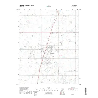
2019 Map of Pryor
USGS Topo · Published 2019About this map
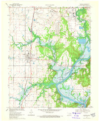
Pryor serves as the central hub of this Mayes County landscape, where the Union Pacific railroad corridor dictates the town's industrial and residential orientation. The area's water geography is well-defined by the winding path of Pryor Creek and several distinct bodies of water including Whitaker Home Pond and the uniquely named Dr Williams Pond Number 5. Genealogists and local historians can find significant research points at the Fairview Cem, Graham Memorial Cem, and the County Home Cem, each marking different chapters of the community's heritage. The map also reveals the localized infrastructure of the era, from the Longs Airport North to the numerous section line roads like ew45 RD and e0490 RD that grid the surrounding agricultural land.
Find a feature on this map
66 named features on this map. Tap any name to fly to it.
Don’t see what you’re looking for? This feature index may not catch every label — zoom into the map to look around manually.
Map Details
Editions of this 2019 Pryor Map
This is the sole edition of this map. No revisions or reprints were ever made.
Other maps of this area

1896 · Pryor
USGS Topo · 1:125,000

1901 · Pryor
USGS Topo · 1:125,000

1954 · Tulsa
USGS Topo · 1:250,000

1958 · Tulsa
USGS Topo · 1:250,000

1963 · Tulsa
USGS Topo · 1:250,000

1969 · Adair
USGS Topo · 1:24,000
1970 · Bushyhead
USGS Topo · 1:24,000
1970 · Osage Hills
USGS Topo · 1:24,000
1970 · Chouteau NW
USGS Topo · 1:24,000
1970 · Chouteau
USGS Topo · 1:24,000