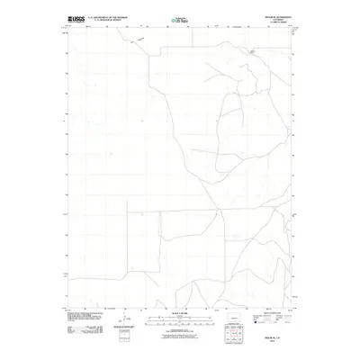
2010 Map of Pryor SE
USGS Topo · Published 2010About this map
The Hogback dominates the northern terrain of this Las Animas County quadrangle, a distinctive geologic formation that orients the sparsely settled landscape. Surveyed in 2010, the area shows the characteristic ranching patterns of southern Colorado, anchored by locations like Williams Ranch in the northeast. The drainage of Tejana Arroyo cuts through the high plains, providing a vital geographical marker in an area defined by wide-spaced homesteads and primitive roads. This map serves as a precise record of rural property and topographical contours at the start of the 21st century, capturing the enduring isolation of the region.
Find a feature on this map
3 named features on this map. Tap any name to fly to it.
Don’t see what you’re looking for? This feature index may not catch every label — zoom into the map to look around manually.
Map Details
Editions of this 2010 Pryor SE Map
This is the sole edition of this map. No revisions or reprints were ever made.
Other maps of this area

1891 · Walsenburg
USGS Topo · 1:125,000

1891 · Spanish Peaks
USGS Topo · 1:125,000

1891 · Apishapa
USGS Topo · 1:125,000

1892 · Elmoro
USGS Topo · 1:125,000

1893 · Spanish Peaks
USGS Topo · 1:125,000

1893 · Apishapa
USGS Topo · 1:125,000

1893 · Elmoro
USGS Topo · 1:125,000

1894 · Walsenburg
USGS Topo · 1:125,000

1895 · Spanish Peaks
USGS Topo · 1:125,000

1897 · Walsenburg
USGS Topo · 1:125,000