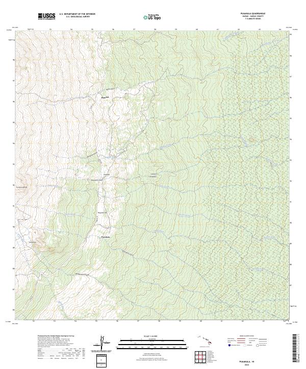
2024 Map of Puaakala
USGS Topo · Published 2024About this map
Hakalau Forest National Wildlife Refuge dominates the windward slopes of the Island of Hawai‘i, where complex drainage systems like Hakalau Stream and Honoli‘i Stream carve through the forested landscape. This contemporary topographic record shows the intersection of conservation land and high-elevation ranching history along Mana Rd. Small clusters of activity are noted at Pua‘akala and Hopuwai, which sit near the boundary of the refuge and private lands. The terrain is defined by deep incisions such as Nāuhi Gulch and Nawaiehu Gulch, while the upper reaches are marked by distinct cinder cones like Pu‘ukahinahina and ‘A‘ahuwela. In the southern portion, the headwaters of the Wailuku River emerge, cutting through the dense vegetation of the volcanic slopes.
Find a feature on this map
22 named features on this map. Tap any name to fly to it.
Don’t see what you’re looking for? This feature index may not catch every label — zoom into the map to look around manually.
Map Details
Editions of this 2024 Puaakala Map
This is the sole edition of this map. No revisions or reprints were ever made.
Other maps of this area

1915 · Honomu
USGS Topo · 1:62,500

1917 · Hilo
USGS Topo · 1:62,500

1930 · Humuula
USGS Topo · 1:62,500

1932 · Hilo
USGS Topo · 1:62,500

1954 · Hawaii North
USGS Topo · 1:250,000

1956 · Puu Oo
USGS Topo · 1:24,000

1956 · Pua Akala
USGS Topo · 1:24,000

1956 · Keanakolu
USGS Topo · 1:24,000

1956 · Upper Piihonua
USGS Topo · 1:24,000

1956 · Mauna Kea
USGS Topo · 1:24,000