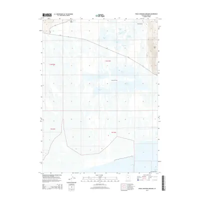
2014 Map of Public Shooting Grounds
USGS Topo · Published 2014About this map
Connor Springs and the expansive wetlands of the eastern Great Salt Lake shoreline define this 2014 survey of Box Elder County. The landscape is a complex network of shallow water bodies, including Pintail Lake, Duck Lake, and Widgeon Lake, which dominate the central terrain south of the Ut-83 corridor. These hydrographic features suggest a specialized environment managed for migratory waterfowl and conservation, reinforced by the presence of Mollys Stocking and the northern reaches of North Bay. To the northeast, the topography rises toward Little Mtn, where elevation changes contrast sharply with the basin floor. Geological and local landmarks such as Painted Rock and Fish Fossil Rocks near Vallery Bay provide specific points of interest for those studying the natural history and fossil record of this unique saline coastal region.
Find a feature on this map
25 named features on this map. Tap any name to fly to it.
Don’t see what you’re looking for? This feature index may not catch every label — zoom into the map to look around manually.
Map Details
Editions of this 2014 Public Shooting Grounds Map
This is the sole edition of this map. No revisions or reprints were ever made.
Other maps of this area

1954 · Whistler Canal
USGS Topo · 1:24,000

1954 · Public Shooting Grounds
USGS Topo · 1:24,000

1954 · Brigham City
USGS Topo · 1:250,000

1955 · Mouth of Bear River
USGS Topo · 1:24,000

1955 · Bear River City
USGS Topo · 1:24,000

1958 · Brigham City
USGS Topo · 1:250,000

1961 · Thatcher Mountain
USGS Topo · 1:62,500

1961 · Tremonton
USGS Topo · 1:24,000

1962 · Brigham City
USGS Topo · 1:250,000

1966 · Thatcher Mountain SW
USGS Topo · 1:24,000