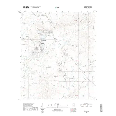
2018 Map of Puckett NW
USGS Topo · Published 2018About this map
Brandon developments and rural Rankin County landscapes meet in this 2018 survey of the Puckett NW quadrangle. The map reveals the expansion of suburban enclaves like Sherwood Forest and Robinhood south of the E Metro Access Rd corridor, contrasted against the deeply dissected terrain of the surrounding hills. Genealogists will find a significant concentration of burial grounds throughout the area, including Hebron Hill Cem, Pearly Grove Cem, and Mays Cem tucked among the drainages of Tumbaloo Cr and Dabbs Cr. A notable landmark for aviation history is the Mohr Farm Airport, situated east of the primary residential blocks. The land remains defined by its topography, rising to locally prominent points such as Rock Hill while being carved by the headwaters of Richland Cr and Dry Cr.
Find a feature on this map
128 named features on this map. Tap any name to fly to it.
Don’t see what you’re looking for? This feature index may not catch every label — zoom into the map to look around manually.
Map Details
Editions of this 2018 Puckett NW Map
This is the sole edition of this map. No revisions or reprints were ever made.
Other maps of this area

1903 · Jackson
USGS Topo · 1:125,000

1905 · Jackson
USGS Topo · 1:48,000

1906 · Florence
USGS Topo · 1:62,500

1908 · Jackson
USGS Topo · 1:62,500

1908 · Florence
USGS Topo · 1:62,500

1922 · Pelahatchee
USGS Topo · 1:48,000

1924 · Pelahatchee
USGS Topo · 1:62,500

1950 · Pelahatchie
USGS Topo · 1:62,500

1952 · Pelahatchie
USGS Topo · 1:62,500

1953 · Meridian
USGS Topo · 1:250,000