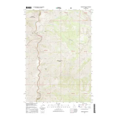
2017 Map of Puddin Mountain
USGS Topo · Published 2017About this map
The Middle Fork Salmon River carves a deep, winding path through this corner of the Payette National Forest and Salmon National Forest. This protected wilderness area, straddling the boundary of Valley County and Lemhi County, is defined by its complex drainage systems and significant elevation changes. Notable stream crossings such as Bighorn Bridge, Waterfall Creek Bridge, and Big Creek Bridge provide critical access points for movement through the steep river canyon. The landscape is dotted with high-altitude water bodies, including West Puddin Lake and Plateau Lake, which sit below prominent peaks like Wilson Mtn. Localized features like Sammy Gulch and the turbulent Jack Creek Rapids illustrate the river's powerful influence on the surrounding topography, shaping a terrain that remains largely undeveloped and primarily focused on forestry and natural resource management.
Find a feature on this map
51 named features on this map. Tap any name to fly to it.
Don’t see what you’re looking for? This feature index may not catch every label — zoom into the map to look around manually.
Map Details
Editions of this 2017 Puddin Mountain Map
This is the sole edition of this map. No revisions or reprints were ever made.
Other maps of this area

1930 · Casto
USGS Topo · 1:125,000

1956 · Elk City
USGS Topo · 1:250,000

1957 · Challis
USGS Topo · 1:250,000

1960 · Elk City
USGS Topo · 1:250,000

1960 · Challis
USGS Topo · 1:250,000

1962 · Bear Creek Point
USGS Topo · 1:24,000

1962 · Hoodoo Meadows
USGS Topo · 1:24,000

1962 · Puddin Mtn
USGS Topo · 1:24,000

1962 · Papoose Peak
USGS Topo · 1:24,000

1962 · Aggipah Mtn
USGS Topo · 1:24,000