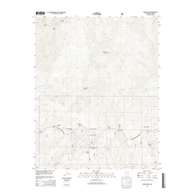
2013 Map of Pueblo Peak
USGS Topo · Published 2013About this map
Pueblo Peak stands as the prominent centerpiece of this high-elevation terrain in the Sangre de Cristo Mountains. Much of the landscape is defined by the Carson National Forest, where a network of deep drainage systems like Frijoles Canyon and Palo Encebado Canyon carve through the massif. The waterways of Rio Pueblo de Taos and Buffalo Grass Cr dictate the natural travel corridors through these peaks, which include Ranchos Peak and Casita de Piedra Peak. The map reveals a land focused on resource management and preservation, shown through the various forest service road designations like 10 and 10a. The drainage patterns, particularly around Burnt Ridge Canyon and Capulin Canyon, offer a clear look at the complex topography that governs this part of the Northern New Mexico highlands.
Find a feature on this map
59 named features on this map. Tap any name to fly to it.
Don’t see what you’re looking for? This feature index may not catch every label — zoom into the map to look around manually.
Map Details
Editions of this 2013 Pueblo Peak Map
This is the sole edition of this map. No revisions or reprints were ever made.
Other maps of this area

1954 · Raton
USGS Topo · 1:250,000

1958 · Raton
USGS Topo · 1:250,000

1963 · Wheeler Peak
USGS Topo · 1:24,000

1963 · Eagle Nest
USGS Topo · 1:24,000

1963 · Arroyo Seco
USGS Topo · 1:24,000

1964 · Taos
USGS Topo · 1:24,000

1964 · Ranchos De Taos
USGS Topo · 1:24,000

1965 · Osha Mountain
USGS Topo · 1:24,000

1965 · Palo Flechado Pass
USGS Topo · 1:24,000

1965 · Pueblo Peak
USGS Topo · 1:24,000