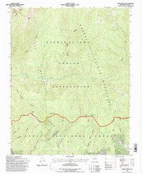
1995 Map of Pueblo Peak
USGS Topo · Published 1997About this map
The Sangre de Cristo Mountains dominate this 1990s terrain, where the northern high desert gives way to the sharp ridges and deep canyons of northern New Mexico. The Pueblo de Taos Indian Reservation covers the northern portion of the map, meeting the Carson National Forest along a boundary that cuts through the drainage of the Rio Pueblo de Taos. This landscape is defined by its topographic extremes, from the summit of Pueblo Peak in the northwest to the complex network of canyons in the south, including Palo Encebado Canyon and Casita de Piedra Canyon. The presence of the Antoine Leroux Grant Boundary reflects the region's long history of land grants and early surveying. Water sources like Capulin Spring and the converging flows of La Junta Creek and Deer Creek highlight the vital riparian corridors that have sustained this arid mountain environment for centuries.
Find a feature on this map
26 named features on this map. Tap any name to fly to it.
Don’t see what you’re looking for? This feature index may not catch every label — zoom into the map to look around manually.
Map Details
Editions of this 1995 Pueblo Peak Map
This is the sole edition of this map. No revisions or reprints were ever made.
Other maps of this area

1954 · Raton
USGS Topo · 1:250,000

1958 · Raton
USGS Topo · 1:250,000

1963 · Wheeler Peak
USGS Topo · 1:24,000

1963 · Eagle Nest
USGS Topo · 1:24,000

1963 · Arroyo Seco
USGS Topo · 1:24,000

1964 · Taos
USGS Topo · 1:24,000

1964 · Ranchos De Taos
USGS Topo · 1:24,000

1965 · Osha Mountain
USGS Topo · 1:24,000

1965 · Palo Flechado Pass
USGS Topo · 1:24,000

1965 · Pueblo Peak
USGS Topo · 1:24,000