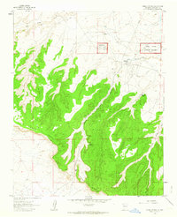
1961 Map of Pueblo Pintado
USGS Topo · Published 1964About this map
Pueblo Pintado (Ruins) and the sprawling boundaries of Chaco Canyon National Monument anchor this high-desert landscape in the early 1960s. The terrain is defined by the massive plateau of Chaco Mesa, which is bisected by the steep-walled Pintado Canyon. This map records a remarkable density of archaeological sites, including several simply labeled Ruins and a Cliff Dwelling, illustrating the significant ancestral Puebloan heritage preserved here. Human activity is focused along Chaco Wash, where the Pueblo Pintado Sch and a nearby Landing Strip represent the modern infrastructure supporting the community and visitors. Water sources, vital in this arid environment, are clearly marked at Ramona Spring and Burro Spring. The map also captures industrial footprints such as a Gravel Pit and a long Pipeline cutting across the northern reaches of the quadrangle.
Find a feature on this map
18 named features on this map. Tap any name to fly to it.
Don’t see what you’re looking for? This feature index may not catch every label — zoom into the map to look around manually.
Map Details
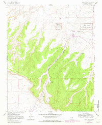
Editions of this 1961 Pueblo Pintado Map
2 editions found
Other maps of this area

1883 · Mt. Taylor
USGS Topo · 1:250,000

1886 · Mt. Taylor
USGS Topo · 1:250,000

1889 · Largo
USGS Topo · 1:250,000

1892 · Mt. Taylor
USGS Topo · 1:250,000

1895 · Largo
USGS Topo · 1:250,000

1899 · Mt. Taylor
USGS Topo · 1:250,000

1954 · Aztec
USGS Topo · 1:250,000

1958 · Aztec
USGS Topo · 1:250,000

1958 · Albuquerque
USGS Topo · 1:250,000

1960 · Pueblo Alto Trading Post
USGS Topo · 1:24,000
Featured Places
- Eastern Navajo Agency, NM
- Pueblo Pintado, Eastern Navajo Agency
- McKinley County, NM
- United States
- New Mexico