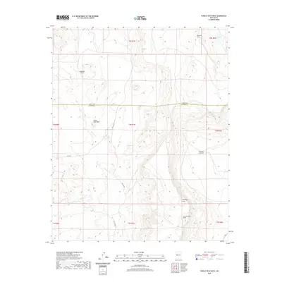
2020 Map of Pueblo Viejo Mesa
USGS Topo · Published 2020About this map
Pueblo Viejo Mesa dominates this high-altitude landscape along the border of Cibola and Socorro Counties, New Mexico. The terrain is defined by a series of prominent mesas and deep canyons, such as Cañon de la Mosca and Cañon de la Ternera, which channel intermittent drainage like Gallegos Cr toward the south and west.
Find a feature on this map
22 named features on this map. Tap any name to fly to it.
Don’t see what you’re looking for? This feature index may not catch every label — zoom into the map to look around manually.
Map Details
Editions of this 2020 Pueblo Viejo Mesa Map
This is the sole edition of this map. No revisions or reprints were ever made.
Other maps of this area

1917 · Cerro Verde
USGS Topo · 1:125,000

1917 · Broom Mountain
USGS Topo · 1:125,000

1954 · Socorro
USGS Topo · 1:250,000

1958 · Socorro
USGS Topo · 1:250,000

1962 · Socorro
USGS Topo · 1:250,000

1964 · Table Mountain
USGS Topo · 1:24,000

1964 · Wiley Mesa
USGS Topo · 1:24,000

1964 · Field Ranch
USGS Topo · 1:24,000
1964 · Cerro Del Oro
USGS Topo · 1:24,000
1964 · Mecate Meadow
USGS Topo · 1:24,000