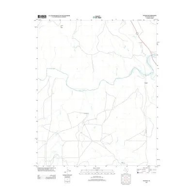
2012 Map of Puente
USGS Topo · Published 2012About this map
Indian Ft Mesa stands as a prominent landmark in this Texas Panhandle landscape, where the Canadian River cuts through the High Plains. The area is defined by a network of established ranching operations, including the Cross Bar Ranch, Fuqua A Bar Ranch, and Fain Ranch, reflecting the enduring legacy of the regional cattle industry. The hydrology of the Potter County terrain is intricate, with numerous seasonal and perennial waterways such as John Ray Creek, Horse Creek, and Windmill Creek feeding into the river valley. In the eastern portion of the map, the settlement of Puente and the convergence of W Amarillo Creek and E Amarillo Creek suggest a pocket of more concentrated activity. This 2012 survey documents the contemporary rural infrastructure, including Western St, against a backdrop of traditional land use and drainage patterns that have shaped this portion of the Llano Estacado.
Find a feature on this map
15 named features on this map. Tap any name to fly to it.
Don’t see what you’re looking for? This feature index may not catch every label — zoom into the map to look around manually.
Map Details
Editions of this 2012 Puente Map
This is the sole edition of this map. No revisions or reprints were ever made.
Other maps of this area

1934 · Ady
USGS Topo · 1:62,500

1934 · Cliffside
USGS Topo · 1:62,500

1936 · Fourways
USGS Topo · 1:62,500

1936 · Cliffside
USGS Topo · 1:62,500

1936 · Ady
USGS Topo · 1:62,500

1953 · Chunky
USGS Topo · 1:24,000

1953 · Marsh
USGS Topo · 1:24,000

1953 · Puente
USGS Topo · 1:24,000

1953 · Pleasant Valley
USGS Topo · 1:24,000

1953 · McDowell Creek
USGS Topo · 1:24,000