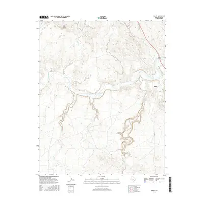
2016 Map of Puente
USGS Topo · Published 2016About this map
Indian Ft Mesa rises above a rugged drainage system in the Texas Panhandle, anchoring a landscape defined by the deep incisions of the Canadian River. This 2016 survey highlights the complex network of intermittent streams and creeks that feed the river valley, including John Ray Creek, Windmill Creek, and Pitcher Creek. The small settlement of Puente sits near the river crossing, where the corridor of Highway 87/287 provides the primary north-south passage through the breaks. The map details how local infrastructure, such as Western Street, navigates the transition from the high mesas down toward the drainage of West Amarillo Creek. This topographical study documents the hydrologic patterns and landforms of Potter County, showing the numerous smaller tributaries like Horse Creek and Ranch Creek that shape the erosional character of the region.
Find a feature on this map
17 named features on this map. Tap any name to fly to it.
Don’t see what you’re looking for? This feature index may not catch every label — zoom into the map to look around manually.
Map Details
Editions of this 2016 Puente Map
This is the sole edition of this map. No revisions or reprints were ever made.
Other maps of this area

1934 · Ady
USGS Topo · 1:62,500

1934 · Cliffside
USGS Topo · 1:62,500

1936 · Fourways
USGS Topo · 1:62,500

1936 · Cliffside
USGS Topo · 1:62,500

1936 · Ady
USGS Topo · 1:62,500

1953 · Chunky
USGS Topo · 1:24,000

1953 · Marsh
USGS Topo · 1:24,000

1953 · Puente
USGS Topo · 1:24,000

1953 · Pleasant Valley
USGS Topo · 1:24,000

1953 · McDowell Creek
USGS Topo · 1:24,000