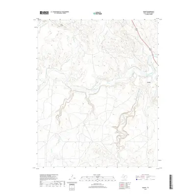
2019 Map of Puente
USGS Topo · Published 2019About this map
Puente sits at the heart of this Potter County landscape, where the Canadian River basin carves a complex network of drainages into the Texas Panhandle. The terrain is defined by prominent elevations such as Indian Ft Mesa and a high density of watercourses that feed the regional watershed. Significant tributaries including John Ray Creek, Windmill Creek, and Little Lahey Creek demonstrate the intricate erosion patterns characteristic of this part of the Llano Estacado. To the east, Pitcher Cr and E Amarillo Cr contribute to the rugged drainage system. Modern infrastructure is represented by the alignment of Western St, providing a clear point of reference for the geographic relationship between the rural settlement of Puente and the surrounding ranching and creek-riven topography.
Find a feature on this map
10 named features on this map. Tap any name to fly to it.
Don’t see what you’re looking for? This feature index may not catch every label — zoom into the map to look around manually.
Map Details
Editions of this 2019 Puente Map
This is the sole edition of this map. No revisions or reprints were ever made.
Other maps of this area

1934 · Ady
USGS Topo · 1:62,500

1934 · Cliffside
USGS Topo · 1:62,500

1936 · Fourways
USGS Topo · 1:62,500

1936 · Cliffside
USGS Topo · 1:62,500

1936 · Ady
USGS Topo · 1:62,500

1953 · Chunky
USGS Topo · 1:24,000

1953 · Marsh
USGS Topo · 1:24,000

1953 · Puente
USGS Topo · 1:24,000

1953 · Pleasant Valley
USGS Topo · 1:24,000

1953 · McDowell Creek
USGS Topo · 1:24,000