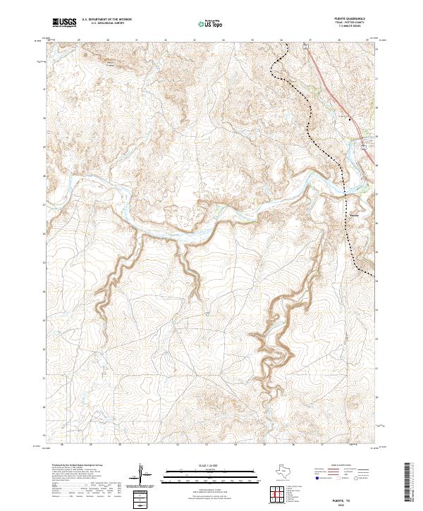
2022 Map of Puente
USGS Topo · Published 2022About this map
The Canadian River cuts a deep, winding path through the High Plains landscape of Potter County, serving as the central geographic feature for this area of the Texas Panhandle. Along the northern bluffs, the Indian Ft Mesa stands as a prominent landmark overlooking the river valley, while the LX Ranch Cem offers a direct connection to the region's ranching heritage. The topography is defined by numerous drainage systems such as Windmill Creek, John Ray Creek, and West Amarillo Creek that have carved complex canyon networks into the surrounding plains.
Find a feature on this map
17 named features on this map. Tap any name to fly to it.
Don’t see what you’re looking for? This feature index may not catch every label — zoom into the map to look around manually.
Map Details
Editions of this 2022 Puente Map
This is the sole edition of this map. No revisions or reprints were ever made.
Other maps of this area

1934 · Ady
USGS Topo · 1:62,500

1934 · Cliffside
USGS Topo · 1:62,500

1936 · Fourways
USGS Topo · 1:62,500

1936 · Cliffside
USGS Topo · 1:62,500

1936 · Ady
USGS Topo · 1:62,500

1953 · Chunky
USGS Topo · 1:24,000

1953 · Marsh
USGS Topo · 1:24,000

1953 · Puente
USGS Topo · 1:24,000

1953 · Pleasant Valley
USGS Topo · 1:24,000

1953 · McDowell Creek
USGS Topo · 1:24,000