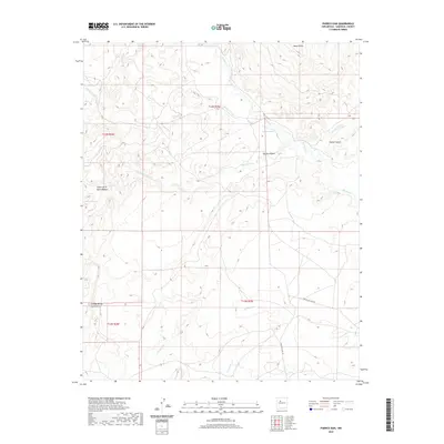
2020 Map of Puerco Dam
USGS Topo · Published 2020About this map
Rio Puerco carves a winding path through this corner of Sandoval County, defining a landscape of deep canyons and high mesas in the high desert of New Mexico. The terrain is marked by significant topographical shifts, most notably at Mesa Prieta and the steep descent into Salado Canyon. A network of ephemeral waterways like Cañada Nervio and Arroyo Cuervo feed into the river valley, illustrating the complex drainage patterns of the region. Transportation in this part of the Rio Puerco valley is defined by tribal and service routes, including Indian Svc Rte 481 and Indian Svc Rte 48. The map also captures several distinct landforms such as Cañon de la Agua Blanca and Cañada de los Canoncitos, offering a detailed view of the varied geological formations that characterize this basin.
Find a feature on this map
18 named features on this map. Tap any name to fly to it.
Don’t see what you’re looking for? This feature index may not catch every label — zoom into the map to look around manually.
Map Details
Editions of this 2020 Puerco Dam Map
This is the sole edition of this map. No revisions or reprints were ever made.
Other maps of this area

1883 · Mt. Taylor
USGS Topo · 1:250,000

1886 · Mt. Taylor
USGS Topo · 1:250,000

1888 · Bernalillo
USGS Topo · 1:125,000

1889 · Albuquerque
USGS Topo · 1:125,000

1892 · Mt. Taylor
USGS Topo · 1:250,000

1893 · Albuquerque
USGS Topo · 1:125,000

1899 · Mt. Taylor
USGS Topo · 1:250,000

1954 · Herrera
USGS Topo · 1:24,000

1954 · Sky Village
USGS Topo · 1:24,000
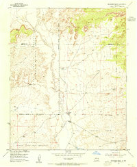
1954 · Benavidez Ranch
USGS Topo · 1:24,000