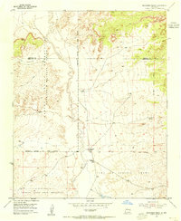
1954 Map of Benavidez Ranch
USGS Topo · Published 1955About this map
Rio Puerco carves a deep meandering path through this mid-century New Mexico landscape, serving as a vital landmark between the Laguna Indian Reservation and the extensive Town of Atrisco Grant. The map highlights the intersection of traditional land grants and modern wildlife management, specifically featuring the State Game and Fish Commission Bird Shelter near the eastern boundary. Settlement is sparse, represented by established outposts like Benavidez Ranch and the nearby Rio Puerco Ranch, which are connected by a network of unimproved roads and a Jeep Trail. The terrain is also defined by administrative and indigenous boundaries, including a corner of the Canoncito Navajo Indian Reservation and the New Mexico Principal Meridian, illustrating the complex layering of federal, state, and tribal lands in Bernalillo County during the early 1950s.
Find a feature on this map
22 named features on this map. Tap any name to fly to it.
Don’t see what you’re looking for? This feature index may not catch every label — zoom into the map to look around manually.
Map Details
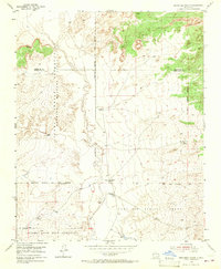
Editions of this 1954 Benavidez Ranch Map
2 editions found
Other maps of this area

1883 · Mt. Taylor
USGS Topo · 1:250,000

1886 · Mt. Taylor
USGS Topo · 1:250,000

1888 · Bernalillo
USGS Topo · 1:125,000

1889 · Albuquerque
USGS Topo · 1:125,000

1892 · Mt. Taylor
USGS Topo · 1:250,000

1893 · Albuquerque
USGS Topo · 1:125,000

1899 · Mt. Taylor
USGS Topo · 1:250,000

1954 · Herrera
USGS Topo · 1:24,000

1954 · Volcano Ranch
USGS Topo · 1:24,000

1954 · Sky Village
USGS Topo · 1:24,000