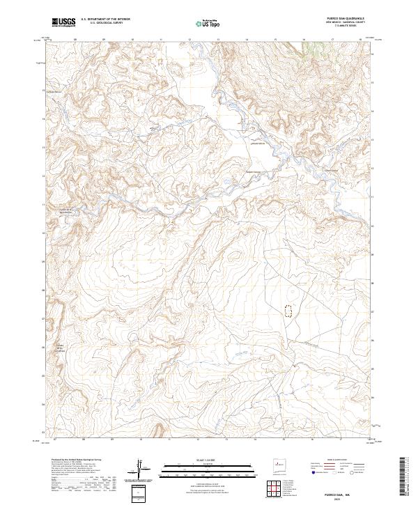
2023 Map of Puerco Dam
USGS Topo · Published 2023About this map
The Rio Puerco drainage system defines the topographic character of this Sandoval County landscape, where deep canyons and arroyos reveal a complex network of seasonal watercourses. Significant terrain features such as Cañada Nervio and Salado Canyon dominate the northern sections, while southern reaches are marked by the numbered channels of Arroyo Nine and Arroyo Six. These features illustrate the erosion patterns typical of the high desert, providing a clear record of how water moves through the high plateaus of New Mexico. Transportation in this area is characterized by bureau routes, specifically Indian Svc Rte 481 and Indian Svc Rte 48, which facilitate movement across the arid plains. Notable landmarks for those studying the area include named geographical points like Cañon Cuervo and Cañon de la Agua Blanca, offering a precise view of the regional landforms as they exist in the early 21st century.
Find a feature on this map
15 named features on this map. Tap any name to fly to it.
Don’t see what you’re looking for? This feature index may not catch every label — zoom into the map to look around manually.
Map Details
Editions of this 2023 Puerco Dam Map
This is the sole edition of this map. No revisions or reprints were ever made.
Other maps of this area

1883 · Mt. Taylor
USGS Topo · 1:250,000

1886 · Mt. Taylor
USGS Topo · 1:250,000

1888 · Bernalillo
USGS Topo · 1:125,000

1889 · Albuquerque
USGS Topo · 1:125,000

1892 · Mt. Taylor
USGS Topo · 1:250,000

1893 · Albuquerque
USGS Topo · 1:125,000

1899 · Mt. Taylor
USGS Topo · 1:250,000

1954 · Herrera
USGS Topo · 1:24,000

1954 · Sky Village
USGS Topo · 1:24,000
1954 · Benavidez Ranch
USGS Topo · 1:24,000