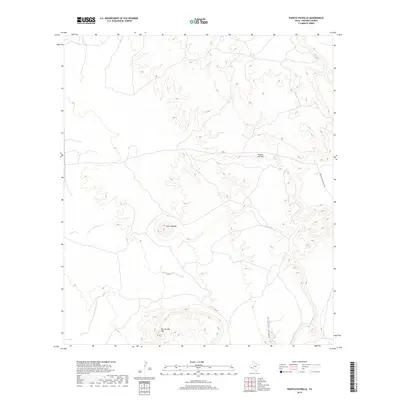
2019 Map of Puerto Potrillo
USGS Topo · Published 2019About this map
San Jacinto Mtn and the isolated peak of Cerro Boludo define the high desert topography of Presidio County in this modern topographic study. The landscape is characterized by its dramatic verticality, from the narrow depths of Fishtail Canyon to the namesake pass at Puerto Potrillo. Situated in a sparsely populated region of West Texas, the map reflects a territory primarily defined by its natural landforms rather than human habitation. The only indicated infrastructure is the Rancho Del Martillo Rd, which skirts the eastern edge of the quadrangle. This layout implies an area dominated by large ranching tracts or protected wilderness, where access is limited and the original Spanish toponyms persist as the primary identifiers of the land.
Find a feature on this map
5 named features on this map. Tap any name to fly to it.
Don’t see what you’re looking for? This feature index may not catch every label — zoom into the map to look around manually.
Map Details
Editions of this 2019 Puerto Potrillo Map
This is the sole edition of this map. No revisions or reprints were ever made.
Other maps of this area

1896 · Shafter
USGS Topo · 1:125,000

1917 · Tascotal Mesa
USGS Topo · 1:62,500

1918 · Jordan Gap
USGS Topo · 1:62,500

1930 · Jordan Gap
USGS Topo · 1:62,500

1944 · Tascotal Mesa
USGS Topo · 1:62,500

1959 · Emory Peak
USGS Topo · 1:250,000

1959 · Presidio
USGS Topo · 1:250,000

1965 · Presidio
USGS Topo · 1:250,000

1965 · Emory Peak
USGS Topo · 1:250,000

1983 · Plata
USGS Topo · 1:24,000