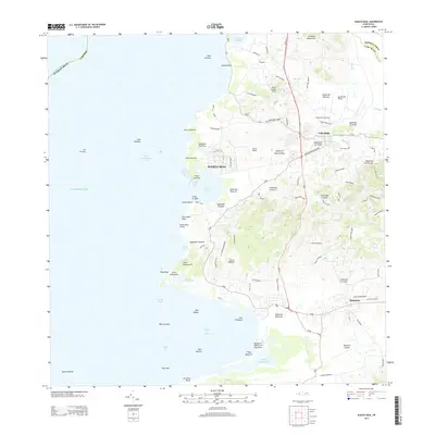
2013 Map of Puerto Real
USGS Topo · Published 2013About this map
The western coastline of Cabo Rojo is defined by a dense network of coastal inlets and mountainous terrain, anchored by the fishing community of Puerto Real. This 2013 survey illustrates the local importance of the coastline, showing the maritime infrastructure of Puerto Real and Joyuda Beach. Inland, the landscape transitions into the hills of Cordillera Sabana Alta and Cerro Conde Ávila, where various streams such as Quebrada Las Tunas and Quebrada Mendoza drain toward the Caribbean Sea.
Find a feature on this map
70 named features on this map. Tap any name to fly to it.
Don’t see what you’re looking for? This feature index may not catch every label — zoom into the map to look around manually.
Map Details
Editions of this 2013 Puerto Real Map
This is the sole edition of this map. No revisions or reprints were ever made.
Other maps of this area

1935 · Puerto Real
USGS Topo · 1:25,000

1937 · San German
USGS Topo · 1:25,000

1937 · Puerto Real
USGS Topo · 1:25,000

1938 · Parguera
USGS Topo · 1:30,000

1938 · Cabo Rojo
USGS Topo · 1:30,000

1939 · Mayaguez
USGS Topo · 1:30,000

1941 · San German
USGS Topo · 1:30,000

1941 · Puerto Real
USGS Topo · 1:30,000

1941 · Rosario
USGS Topo · 1:30,000

1942 · Rosario
USGS Topo · 1:30,000
Featured Places
- Cabo Rojo
- Reparto Vista Verde, Cabo Rojo
- Villa Tortuga, Cabo Rojo
- Sector Souchet, Cabo Rojo
- El Fuego y Las Piedras, Cabo Rojo