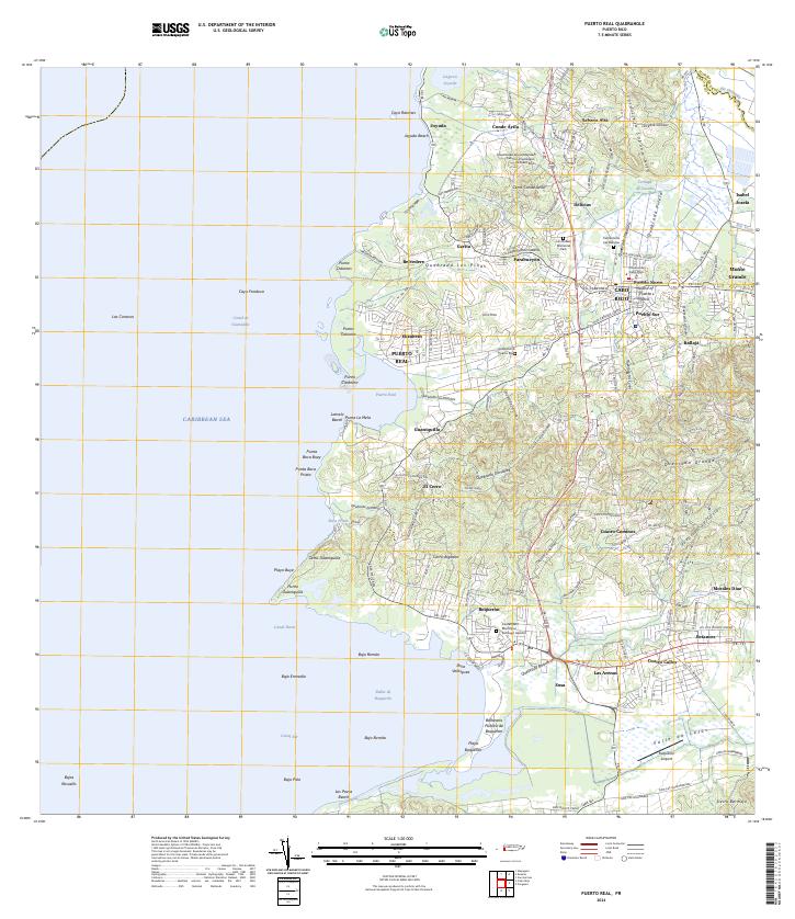
2024 Map of Puerto Real
USGS Topo · Published 2024About this map
Cabo Rojo serves as the inland anchor for this coastal region, where the town's urban core transitions into the low-lying Valle de Lajas and the surrounding hills. This survey documents the complex interface between the developed sectors of Pueblo Norte and Pueblo Sur and the ecological margins of the Caribbean Sea. The geography is defined by its water systems, from the expansive Laguna Joyuda in the north to the intricate drainage of Quebrada Grande and Quebrada Boquerón. Cultural landmarks are densely mapped, including the Universidad Ana G Méndez Centro Universitario de Cabo Rojo and the Tribunal de Cabo Rojo. Along the shoreline, the importance of maritime and recreational life is evident through features like Puerto Real, the Balneario Público de Boquerón, and the Boquerón Airport. The map also preserves the locations of local rest, such as the Cementerio Municipal Santiago Apóstol and Cementerio Las Delicias.
Find a feature on this map
163 named features on this map. Tap any name to fly to it.
Don’t see what you’re looking for? This feature index may not catch every label — zoom into the map to look around manually.
Map Details
Editions of this 2024 Puerto Real Map
This is the sole edition of this map. No revisions or reprints were ever made.
Other maps of this area

1935 · Puerto Real
USGS Topo · 1:25,000

1937 · San German
USGS Topo · 1:25,000

1937 · Puerto Real
USGS Topo · 1:25,000

1938 · Parguera
USGS Topo · 1:30,000

1938 · Cabo Rojo
USGS Topo · 1:30,000

1939 · Mayaguez
USGS Topo · 1:30,000

1941 · San German
USGS Topo · 1:30,000

1941 · Puerto Real
USGS Topo · 1:30,000

1941 · Rosario
USGS Topo · 1:30,000

1942 · Rosario
USGS Topo · 1:30,000
Featured Places
- Cabo Rojo
- Reparto Vista Verde, Cabo Rojo
- El Fuego y Las Piedras, Cabo Rojo
- Villa Tortuga, Cabo Rojo
- Sector Souchet, Cabo Rojo