
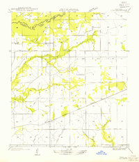
1947 Map of Pujo
USGS Topo · Published 1947About this map
Anacoco Bayou marks the northern border of this West Louisiana landscape, defining the transition from Vernon Parish into Beauregard Parish. The map reveals an area deeply shaped by the timber industry and emerging transportation networks, most notably the numerous corridors marked as Old Logging Railroad Grade. These historic tracks crisscross the terrain alongside active rail lines like the Gulf Colorado and Santa Fe.
Find a feature on this map
17 named features on this map. Tap any name to fly to it.
Don’t see what you’re looking for? This feature index may not catch every label — zoom into the map to look around manually.
Map Details
Editions of this 1947 Pujo Map
This is the sole edition of this map. No revisions or reprints were ever made.
Other maps of this area

1946 · Merryville
USGS Topo · 1:31,680

1947 · Singer
USGS Topo · 1:31,680

1947 · DeRidder
USGS Topo · 1:31,680

1947 · Rosepine
USGS Topo · 1:31,680

1947 · Knight
USGS Topo · 1:31,680

1947 · Bivens
USGS Topo · 1:31,680

1947 · Beckwith School
USGS Topo · 1:31,680

1949 · Evans
USGS Topo · 1:31,680

1952 · Lake Charles
USGS Topo · 1:250,000
1954 · Pujo
USGS Topo · 1:31,680