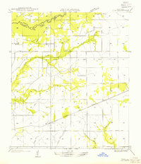
1954 Map of Pujo
USGS Topo · Published 1954About this map
Anacoco Bayou forms the winding northern boundary of this landscape, separating Vernon and Beauregard Parishes. The area is defined by its transition from timber production to established rural communities, evidenced by the extensive network of the Old Logging Railroad Grade that crisscrosses the terrain. These abandoned routes indicate the heavy logging activity that preceded the mid-century settlement patterns seen here, where small spiritual centers like Damascene Ch and Cooper Ch serve the local population near the U S Highway No 190 corridor.
Find a feature on this map
15 named features on this map. Tap any name to fly to it.
Don’t see what you’re looking for? This feature index may not catch every label — zoom into the map to look around manually.
Map Details
Editions of this 1954 Pujo Map
This is the sole edition of this map. No revisions or reprints were ever made.
Other maps of this area

1946 · Merryville
USGS Topo · 1:31,680

1947 · Singer
USGS Topo · 1:31,680

1947 · Pujo
USGS Topo · 1:31,680

1947 · DeRidder
USGS Topo · 1:31,680

1947 · Rosepine
USGS Topo · 1:31,680

1947 · Knight
USGS Topo · 1:31,680

1947 · Bivens
USGS Topo · 1:31,680

1947 · Beckwith School
USGS Topo · 1:31,680

1949 · Evans
USGS Topo · 1:31,680

1952 · Lake Charles
USGS Topo · 1:250,000