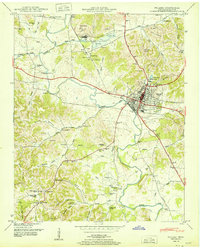
1951 Map of Pulaski
USGS Topo · Published 1951About this map
The regional hub of Pulaski serves as the focal point of this 1951 survey, situated at the intersection of the Louisville and Nashville railroad and the Bee Line Highway. The town's grid is well-defined, featuring prominent local landmarks such as Maplewood Cem, Bridgeforth Sch, and the Radio tower (WKSR). North of the city, the landscape is marked by industrial activity, including several Strip Mines and associated Tailings ponds near the settlement of Wales.
Find a feature on this map
73 named features on this map. Tap any name to fly to it.
Don’t see what you’re looking for? This feature index may not catch every label — zoom into the map to look around manually.
Map Details
Editions of this 1951 Pulaski Map
This is the sole edition of this map. No revisions or reprints were ever made.
Other maps of this area

1936 · Milky Way
USGS Topo · 1:24,000

1936 · Aspen Hill
USGS Topo · 1:24,000

1936 · Campbellsville
USGS Topo · 1:24,000

1936 · Brick Church
USGS Topo · 1:24,000

1936 · Pulaski
USGS Topo · 1:24,000

1936 · Bodenham
USGS Topo · 1:24,000

1936 · Appleton
USGS Topo · 1:24,000

1936 · Tarpley
USGS Topo · 1:24,000

1936 · Elkton
USGS Topo · 1:24,000

1946 · Brick Church
USGS Topo · 1:24,000