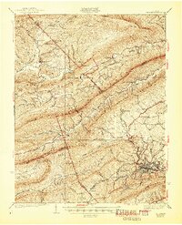
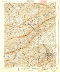
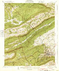
1940 Map of Pulaski
USGS Topo · Published 1945About this map
Pulaski serves as the industrial and transportation hub for this portion of the New River Valley, where the Norfolk and Western railway snakes through the complex ridges of Southwest Virginia. The landscape is defined by the sharp parallel ridges of Walker Mountain and Little Walker Mountain, creating a series of narrow valleys where isolated communities like Holly Brook and Mechanicsburg developed around local water sources and mountain gaps.
Find a feature on this map
78 named features on this map. Tap any name to fly to it.
Don’t see what you’re looking for? This feature index may not catch every label — zoom into the map to look around manually.
Map Details
Editions of this 1940 Pulaski Map
3 editions found
Other maps of this area

1887 · Pocahontas
USGS Topo · 1:125,000

1889 · Hillsville
USGS Topo · 1:125,000

1889 · Wytheville
USGS Topo · 1:125,000

1890 · Dublin
USGS Topo · 1:125,000

1891 · Pocahontas
USGS Topo · 1:125,000

1891 · Dublin
USGS Topo · 1:125,000

1892 · Hillsville
USGS Topo · 1:125,000

1892 · Wytheville
USGS Topo · 1:125,000

1894 · Pocahontas
USGS Topo · 1:125,000

1895 · Pocahontas
USGS Topo · 1:125,000