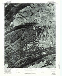
1976 Map of Pulaski
USGS Topo · Published 1983About this map
Pulaski serves as the industrial and social hub of this mid-1970s orthophotograph, where the dense grid of the town core meets the sharp rise of Draper Mountain. This imagery, produced in cooperation with the Soil Conservation Service, reveals a landscape defined by the contrast between organized agriculture in the lowlands and the heavy timber of the ridges. The impounded waters of Gatewood Reservoir and Hogan Lake indicate the managed water resources essential for the region's development during this era. To the south, the settlement of Draper sits near the foot of the mountain, while Mt Olivet occupies a central position amidst the complex drainage patterns of Peak Creek and Eddys Branch. The map provides a literal ground-truth of land use, showing the exact clearing limits of farms against the steep, shaded slopes of Brushy Ridge.
Find a feature on this map
10 named features on this map. Tap any name to fly to it.
Don’t see what you’re looking for? This feature index may not catch every label — zoom into the map to look around manually.
Map Details
Editions of this 1976 Pulaski Map
This is the sole edition of this map. No revisions or reprints were ever made.
Other maps of this area

1889 · Hillsville
USGS Topo · 1:125,000

1890 · Dublin
USGS Topo · 1:125,000

1891 · Dublin
USGS Topo · 1:125,000

1892 · Hillsville
USGS Topo · 1:125,000

1896 · Hillsville
USGS Topo · 1:125,000

1930 · Max Meadows
USGS Topo · 1:62,500

1934 · Pulaski
USGS Topo · 1:48,000

1940 · Pulaski
USGS Topo · 1:62,500

1950 · Radford
USGS Topo · 1:62,500

1953 · Winston-Salem
USGS Topo · 1:250,000