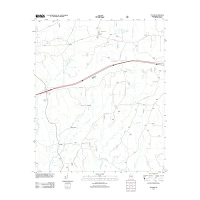
2012 Map of Pulaski
USGS Topo · Published 2012About this map
The settlement of Pulaski serves as the focal point for this rural Scott County landscape, where the Strong River and its numerous tributaries like Shockalod Cr and Caney Cr define the drainage patterns of the region. This 2012 survey documents a network of rural communities, including Raworth, Kalem, and Hunter Town, connected by a web of local routes such as Hillsboro Rd and Morton-Marathon Rd. For those researching local family histories, the map identifies several burial grounds including North Morton Cem, Sims Cem, and Luther Chapel Cem. Notable landmarks like the Moore Fire Tower on the eastern side and Spencer Hill to the west provide topographical context to the woodlots and clearings. The presence of smaller named locales like Frogtown and Green Barn suggests a persistent pattern of local identity within this traditional Mississippi agricultural and timber-producing corridor.
Find a feature on this map
45 named features on this map. Tap any name to fly to it.
Don’t see what you’re looking for? This feature index may not catch every label — zoom into the map to look around manually.
Map Details
Editions of this 2012 Pulaski Map
This is the sole edition of this map. No revisions or reprints were ever made.
Other maps of this area

1921 · Forest
USGS Topo · 1:48,000

1922 · Forest
USGS Topo · 1:62,500

1922 · Morton
USGS Topo · 1:48,000

1924 · Morton
USGS Topo · 1:62,500

1950 · Forest
USGS Topo · 1:62,500

1951 · Morton
USGS Topo · 1:62,500

1952 · Forest
USGS Topo · 1:62,500

1953 · Meridian
USGS Topo · 1:250,000

1957 · Meridian
USGS Topo · 1:250,000

1965 · Meridian
USGS Topo · 1:250,000