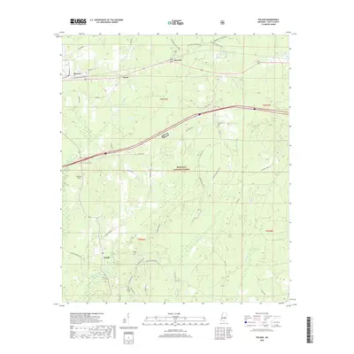
2018 Map of Pulaski
USGS Topo · Published 2018About this map
Bienville National Forest dominates much of this Scott County landscape, where the Strong River and Tallabogue creek systems drain through timbered terrain. The settlement at Pulaski serves as a local anchor in the southern portion of the map, connected to surrounding areas by a network of rural routes like Morton-Marathon Rd and Blossom Hill Rd. To the north, the corridor following Old Hwy 80 E links the communities of Morton, Kalem, and Raworth, illustrating the historic east-west transit pattern through the region. Genealogists will find significant value in the distribution of family-named burial grounds, including Searcy Cem, Faulkner Cem, and Brassell Cem, which are scattered throughout the forest and along the ridges near Spencer Hill. The map also traces recreational paths like the Shongelo Hiking Trail and Shockaloe Horse Trail, reflecting the area's dual use for industry and recreation.
Find a feature on this map
46 named features on this map. Tap any name to fly to it.
Don’t see what you’re looking for? This feature index may not catch every label — zoom into the map to look around manually.
Map Details
Editions of this 2018 Pulaski Map
This is the sole edition of this map. No revisions or reprints were ever made.
Other maps of this area

1921 · Forest
USGS Topo · 1:48,000

1922 · Forest
USGS Topo · 1:62,500

1922 · Morton
USGS Topo · 1:48,000

1924 · Morton
USGS Topo · 1:62,500

1950 · Forest
USGS Topo · 1:62,500

1951 · Morton
USGS Topo · 1:62,500

1952 · Forest
USGS Topo · 1:62,500

1953 · Meridian
USGS Topo · 1:250,000

1957 · Meridian
USGS Topo · 1:250,000

1965 · Meridian
USGS Topo · 1:250,000