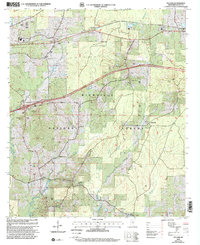
2000 Map of Pulaski
USGS Topo · Published 2002About this map
Bienville National Forest dominates this landscape in central Mississippi, where timberland is intersected by a network of small creeks and rural communities. This survey reveals a pattern of dispersed settlement, with many homes clustered near historic nodes like Pulaski and Frogtown. The presence of numerous small cemeteries and country churches, such as Mt Moriah Ch and Luther Chapel, points to long-established family lineages rooted in these woods.
Find a feature on this map
35 named features on this map. Tap any name to fly to it.
Don’t see what you’re looking for? This feature index may not catch every label — zoom into the map to look around manually.
Map Details
Editions of this 2000 Pulaski Map
This is the sole edition of this map. No revisions or reprints were ever made.
Other maps of this area

1921 · Forest
USGS Topo · 1:48,000

1922 · Forest
USGS Topo · 1:62,500

1922 · Morton
USGS Topo · 1:48,000

1924 · Morton
USGS Topo · 1:62,500

1950 · Forest
USGS Topo · 1:62,500

1951 · Morton
USGS Topo · 1:62,500

1952 · Forest
USGS Topo · 1:62,500

1953 · Meridian
USGS Topo · 1:250,000

1957 · Meridian
USGS Topo · 1:250,000

1965 · Meridian
USGS Topo · 1:250,000