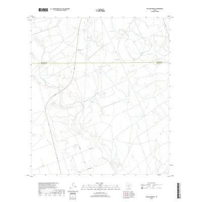
2019 Map of Pulliam Ranch
USGS Topo · Published 2019About this map
Pulliam Ranch sits as the central namesake of this south Texas landscape, where the Uvalde Co and Zavala Co line divides a region defined by its critical water sources. The Nueces River winds through the southwestern corner, creating a riparian corridor that contrasts with the surrounding drainage networks of Sand Ridge Cr and Live Oak Cr. The map reveals a high density of named stock tanks, such as Ninemile Tank, Horseshoe Tank, and Ranger Tank, reflecting the essential nature of water management in this cattle-ranching territory. Local infrastructure is marked by a network of rural roads including Nueces Rd and Corrgan Rd, which provide access to the interior rangelands. Further east, the Camp Lake Slough indicates low-lying areas prone to seasonal inundation, while FM 117 skirts the northeastern edge of the survey.
Find a feature on this map
20 named features on this map. Tap any name to fly to it.
Don’t see what you’re looking for? This feature index may not catch every label — zoom into the map to look around manually.
Map Details
Editions of this 2019 Pulliam Ranch Map
This is the sole edition of this map. No revisions or reprints were ever made.
Other maps of this area

1898 · Uvalde
USGS Topo · 1:125,000

1899 · Uvalde
USGS Topo · 1:125,000

1939 · La Pryor
USGS Topo · 1:62,500

1953 · Crystal City
USGS Topo · 1:250,000

1954 · San Antonio
USGS Topo · 1:250,000

1955 · Crystal City
USGS Topo · 1:250,000

1957 · San Antonio
USGS Topo · 1:250,000

1957 · Batesville
USGS Topo · 1:62,500
1960 · Hacienda
USGS Topo · 1:24,000

1960 · Pulliam Ranch
USGS Topo · 1:24,000