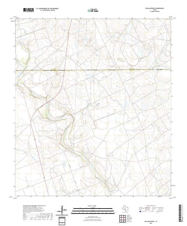
2022 Map of Pulliam Ranch
USGS Topo · Published 2022About this map
The Nueces River winds through the South Texas brush country along the border of Uvalde Co and Zavala Co, marking a landscape defined by ranching water infrastructure. This modern survey illustrates the critical role of artificial water sources in this arid environment, featuring numerous named reservoirs such as Willow Tank, Ninemile Tank, and Live Oak Tank. The drainage patterns of Mustang Cr and Sand Ridge Cr emphasize the subtle topography of the Nueces basin.
Find a feature on this map
19 named features on this map. Tap any name to fly to it.
Don’t see what you’re looking for? This feature index may not catch every label — zoom into the map to look around manually.
Map Details
Editions of this 2022 Pulliam Ranch Map
This is the sole edition of this map. No revisions or reprints were ever made.
Other maps of this area

1898 · Uvalde
USGS Topo · 1:125,000

1899 · Uvalde
USGS Topo · 1:125,000

1939 · La Pryor
USGS Topo · 1:62,500

1953 · Crystal City
USGS Topo · 1:250,000

1954 · San Antonio
USGS Topo · 1:250,000

1955 · Crystal City
USGS Topo · 1:250,000

1957 · San Antonio
USGS Topo · 1:250,000

1957 · Batesville
USGS Topo · 1:62,500
1960 · Hacienda
USGS Topo · 1:24,000

1960 · Pulliam Ranch
USGS Topo · 1:24,000