
1958 Map of Pullman
USGS Topo · Published 1958About this map
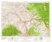
The Snake River and Clearwater River meet at the hub of Lewiston and Clarkston, forming a geographic anchor for this mid-century look at the Palouse and northern Idaho. In the late 1950s, the landscape is defined by the deep canyons of the Snake River and the high plateaus where agricultural centers like Pullman and Moscow thrive. The complex transportation network of the era is evident through the winding routes of the Camas Prairie RR and the Northern Pacific RR, which navigated the difficult grades of the Craig Mountain plateau and the river valleys. To the east, the timber-heavy terrain of the Saint Joe National Forest and the Nez Perce Indian Reservation dominates, showing the transition from the rolling wheat fields of Whitman County to the steep, forested slopes of the Clearwater drainage near Orofino. Small railroad towns and settlements like Bovill, Elk River, and Pierce mark the reaches of industrial activity into the mountain interior.
Find a feature on this map
240 named features on this map. Tap any name to fly to it.
Don’t see what you’re looking for? This feature index may not catch every label — zoom into the map to look around manually.
Map Details
Editions of this 1958 Pullman Map
2 editions found
Other maps of this area

1903 · Oakesdale
USGS Topo · 1:125,000

1905 · Oakesdale
USGS Topo · 1:125,000

1910 · Pullman
USGS Topo · 1:125,000

1914 · Avery
USGS Topo · 1:125,000

1917 · Avery
USGS Topo · 1:125,000

1919 · Walla Walla
USGS Topo · 1:125,000

1921 · Walla Walla
USGS Topo · 1:125,000

1923 · Washington Creek
USGS Topo · 1:125,000

1924 · Kamiah
USGS Topo · 1:125,000

1924 · Weippe
USGS Topo · 1:125,000