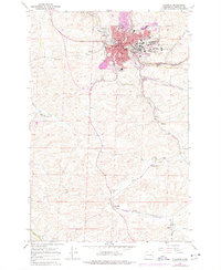
1964 Map of Pullman
USGS Topo · Published 1977About this map
Washington State University serves as a major focal point in this mid-1960s study of the Pullman area, with the campus and its Observatory standing out on the eastern edge of the city. The landscape is a complex intersection of academic, agricultural, and industrial activity, where the South Fork Palouse River meets Paradise Creek near the center of town. The influence of the university extends into the surrounding countryside through the WSU Experimental Farm, highlighting the region's agricultural importance.
Find a feature on this map
39 named features on this map. Tap any name to fly to it.
Don’t see what you’re looking for? This feature index may not catch every label — zoom into the map to look around manually.
Map Details
Editions of this 1964 Pullman Map
3 editions found
Other maps of this area

1910 · Pullman
USGS Topo · 1:125,000

1955 · Pullman
USGS Topo · 1:250,000

1958 · Pullman
USGS Topo · 1:250,000

1964 · Viola
USGS Topo · 1:24,000

1964 · Moscow West
USGS Topo · 1:24,000

1964 · Colton
USGS Topo · 1:24,000
1964 · Albion
USGS Topo · 1:24,000

1964 · Colfax South
USGS Topo · 1:24,000

1964 · Ewartsville
USGS Topo · 1:24,000

1964 · Bishop
USGS Topo · 1:24,000