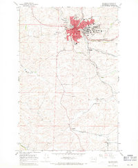
1964 Map of Pullman
USGS Topo · Published 1971About this map
Washington State University anchors the northeastern portion of this mid-1960s survey, showing a campus in the midst of expansion with its Observatory and adjacent Golf Course. The urban core of Pullman is dense with civic infrastructure, including Jefferson Sch, Edison Sch, and Lincoln Jr High Sch, alongside specialized sites like the Drive-in Theater and Sewage Disposal plant. The surrounding Palouse hills reflect a deep agricultural and extractive economy, evidenced by the WSU Experimental Farm and numerous industrial sites such as Whitlow Quarry and various Gravel Pits.
Find a feature on this map
35 named features on this map. Tap any name to fly to it.
Don’t see what you’re looking for? This feature index may not catch every label — zoom into the map to look around manually.
Map Details
Editions of this 1964 Pullman Map
3 editions found
Other maps of this area

1910 · Pullman
USGS Topo · 1:125,000

1955 · Pullman
USGS Topo · 1:250,000

1958 · Pullman
USGS Topo · 1:250,000

1964 · Viola
USGS Topo · 1:24,000

1964 · Moscow West
USGS Topo · 1:24,000

1964 · Colton
USGS Topo · 1:24,000
1964 · Albion
USGS Topo · 1:24,000

1964 · Colfax South
USGS Topo · 1:24,000

1964 · Ewartsville
USGS Topo · 1:24,000

1964 · Bishop
USGS Topo · 1:24,000