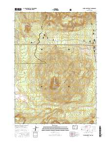
2017 Map of Pumice Desert East
USGS Topo · Published 2017About this map
Crater Lake National Park occupies the southern half of this landscape, where the volcanic geology of the High Cascades is evident in the prominent rise of Timber Crater. The terrain is defined by the intersection of three major protected areas, as the park boundary meets the Umpqua National Forest to the northwest and the Winema National Forest to the northeast. A significant stretch of the Pacific Crest National Scenic Trail winds through the western portion of the map, following the high ground near Summit Rock and the edge of the Pumice Desert. This open, arid expanse contrasts with the surrounding timberlands, illustrating the unique drainage patterns of the region where seasonal watercourses like Desert Cr and Tiny Cr navigate the porous volcanic soils. To the south, high points like Grouse Hill and Sharp Peak mark the transition toward the caldera rim beyond the map's southern edge.
Find a feature on this map
22 named features on this map. Tap any name to fly to it.
Don’t see what you’re looking for? This feature index may not catch every label — zoom into the map to look around manually.
Map Details
Editions of this 2017 Pumice Desert East Map
This is the sole edition of this map. No revisions or reprints were ever made.
Other maps of this area

1889 · Klamath
USGS Topo · 1:250,000

1891 · Ashland
USGS Topo · 1:250,000

1893 · Ashland
USGS Topo · 1:250,000

1894 · Klamath
USGS Topo · 1:250,000

1897 · Ashland
USGS Topo · 1:250,000

1917 · Diamond Lake
USGS Topo · 1:125,000

1935 · Chemult
USGS Topo · 1:96,000

1941 · Chemult
USGS Topo · 1:125,000

1955 · Crescent
USGS Topo · 1:250,000

1955 · Klamath Falls
USGS Topo · 1:250,000