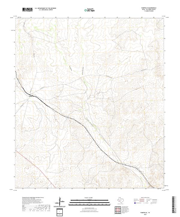
2022 Map of Pumpville
USGS Topo · Published 2022About this map
Pumpville serves as the central landmark in this high-desert landscape of Val Verde County, situated where the high plains break into a complex system of drainage's. The terrain is defined by the deep incisions of Pumpville Canyon and Osman Canyon, which channel seasonal runoff toward the Rio Grande basin. The map records a network of ranching infrastructure, including Arledge Ranch Rd and Arledge Rd W, which navigate the plateaus between ephemeral watercourses like Osman Draw and Antonio Cr. This 2022 survey captures the modern rural character of the West Texas borderlands, showing how contemporary transportation routes like Ranch Rd 1865 follow the natural contours established by the local canyon systems.
Find a feature on this map
10 named features on this map. Tap any name to fly to it.
Don’t see what you’re looking for? This feature index may not catch every label — zoom into the map to look around manually.
Map Details
Editions of this 2022 Pumpville Map
This is the sole edition of this map. No revisions or reprints were ever made.
Other maps of this area

1943 · Malvado
USGS Topo · 1:62,500

1943 · Langtry
USGS Topo · 1:62,500

1944 · Malvado
USGS Topo · 1:62,500

1954 · Sonora
USGS Topo · 1:250,000

1958 · Sonora
USGS Topo · 1:250,000

1958 · Del Rio
USGS Topo · 1:250,000

1964 · Del Rio
USGS Topo · 1:250,000

1970 · Little Fielder Draw
USGS Topo · 1:24,000

1973 · Langtry
USGS Topo · 1:24,000
1973 · Harkell Canyon
USGS Topo · 1:24,000