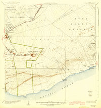
1924 Map of Puna
USGS Topo · Published 1940About this map
The volcanic landscape of the Puna District meets the edge of the Pacific Ocean in this early twentieth-century survey. Notable for its documentation of active geology, the map records the extensive Lava Flow of 1840 and a series of craters within Hawaii National Park, including Makaopuhi Crater, Pauahi Crater, and Kilauea Iki Crater. Beyond the volcanic activity, the map reveals a system of land distribution in the territory, from the Olaa Reservation Lots and Olaa Summer Lots in the north to the Kauka Homesteads and Kupahua Homesteads further east. Traditional infrastructure like the Volcano Road and Chain of Craters Road connects the settlements, while the interior is marked by various forest reserves and the Volcano School.
Find a feature on this map
63 named features on this map. Tap any name to fly to it.
Don’t see what you’re looking for? This feature index may not catch every label — zoom into the map to look around manually.
Map Details
Editions of this 1924 Puna Map
2 editions found
Other maps of this area

1917 · Hilo
USGS Topo · 1:62,500

1921 · Kilauea
USGS Topo · 1:62,500

1922 · Puna
USGS Topo · 1:62,500

1923 · Pahala
USGS Topo · 1:62,500

1924 · Makuu
USGS Topo · 1:62,500

1924 · Kilauea
USGS Topo · 1:62,500

1924 · Puna
USGS Topo · 1:62,500

1924 · Kalapana
USGS Topo · 1:62,500

1930 · Humuula
USGS Topo · 1:62,500

1932 · Hilo
USGS Topo · 1:62,500