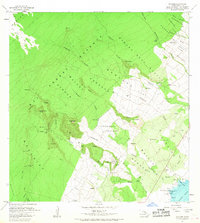
1966 Map of Punaluu
USGS Topo · Published 1968About this map
Punaluu and the adjacent Ninole-Wailau Homesteads represent a critical intersection of indigenous Hawaiian history and the industrial sugar era in the Kau District. Along the coast, the presence of the Kaneeleele Heiau and Kaieie Heiau near Koloa Beach marks ancient cultural sites situated just yards from the Old Railroad Grade and Punaluu Harbor. This landscape is physically defined by volcanic activity, most notably the massive Kahuku Lava Flow of 1950 that scarred the western upland near the Kau Forest Reserve. Inland, the map documents the labor geography of the region through named plantation settlements like Higashi Camp and Middle Moaula Camp. These camps, along with numerous water tunnels and tanks, illustrate the complex infrastructure required to support agricultural life on the slopes of Moaula and Puu Enuhe.
Find a feature on this map
70 named features on this map. Tap any name to fly to it.
Don’t see what you’re looking for? This feature index may not catch every label — zoom into the map to look around manually.
Map Details
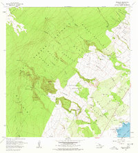
Editions of this 1966 Punaluu Map
2 editions found
Other maps of this area

1921 · Kilauea
USGS Topo · 1:62,500

1923 · Pahala
USGS Topo · 1:62,500

1924 · Kilauea
USGS Topo · 1:62,500

1924 · Honuapo
USGS Topo · 1:62,500

1928 · Mauna Loa
USGS Topo · 1:62,500

1954 · Hawaii South
USGS Topo · 1:250,000

1959 · Hawaii South
USGS Topo · 1:250,000

1961 · Hawaii South
USGS Topo · 1:250,000

1962 · Hawaii South
USGS Topo · 1:250,000

1962 · Kahuku Ranch
USGS Topo · 1:24,000